File:DEMap-doton-Dover.png
No higher resolution available.
DEMap-doton-Dover.png (139 × 300 pixels, file size: 4 KB, MIME type: image/png)
Summary
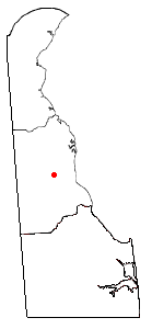
Map of Delaware, showing the position of Dover. Uploaded in en:wiki by en:User:Bumm13. Adapted from Wikipedia's DE county maps by Bumm13.
Licensing
| This file is licensed under the Creative Commons Attribution-Share Alike 3.0 Unported license. Subject to disclaimers. | ||
| ||
| This licensing tag was added to this file as part of the GFDL licensing update. |

|
Permission is granted to copy, distribute and/or modify this document under the terms of the GNU Free Documentation License, Version 1.2 or any later version published by the Free Software Foundation; with no Invariant Sections, no Front-Cover Texts, and no Back-Cover Texts. A copy of the license is included in the section entitled GNU Free Documentation License. Subject to disclaimers. |
File history
Click on a date/time to view the file as it appeared at that time.
| Date/Time | Thumbnail | Dimensions | User | Comment | |
|---|---|---|---|---|---|
| current | 22:28, 5 Septemba 2006 | | 139 × 300 (4 KB) | Joao Xavier | Map of Delaware, showing the position of Dover. Uploaded in en:wiki by en:User:Bumm13. Adapted from Wikipedia's DE county maps by Bumm13. category:Delaware |
File usage
The following page uses this file:
Global file usage
The following other wikis use this file:
- Usage on af.wikipedia.org
- Usage on br.wikipedia.org
- Usage on ca.wikipedia.org
- Usage on ceb.wikipedia.org
- Usage on en.wikipedia.org
- Usage on en.wikinews.org
- Usage on ext.wikipedia.org
- Usage on fa.wikipedia.org
- Usage on gl.wikipedia.org
- Usage on he.wikipedia.org
- Usage on io.wikipedia.org
- Usage on it.wikipedia.org
- Usage on ja.wikipedia.org
- Usage on kw.wikipedia.org
- Usage on oc.wikipedia.org
- Usage on qu.wikipedia.org
- Usage on tr.wikipedia.org