File:EU-Hungary.svg

Size of this PNG preview of this SVG file: 713 × 600 pixels. Other resolutions: 285 × 240 pixels | 571 × 480 pixels | 913 × 768 pixels | 1,218 × 1,024 pixels | 2,435 × 2,048 pixels | 2,045 × 1,720 pixels.
Original file (SVG file, nominally 2,045 × 1,720 pixels, file size: 7.33 MB)
Summary
| Description |
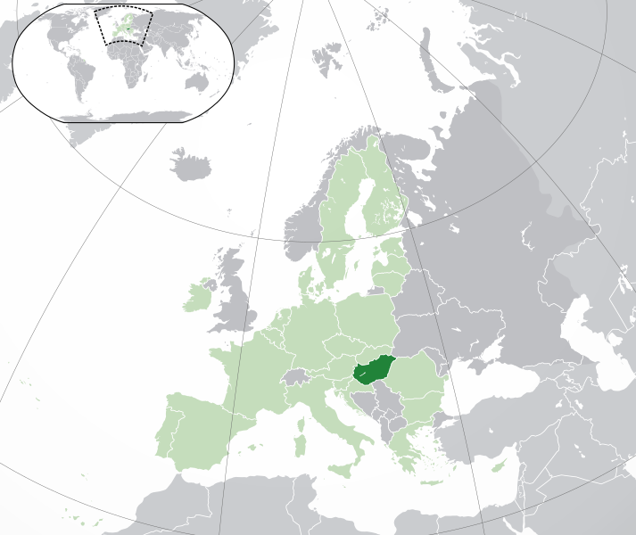
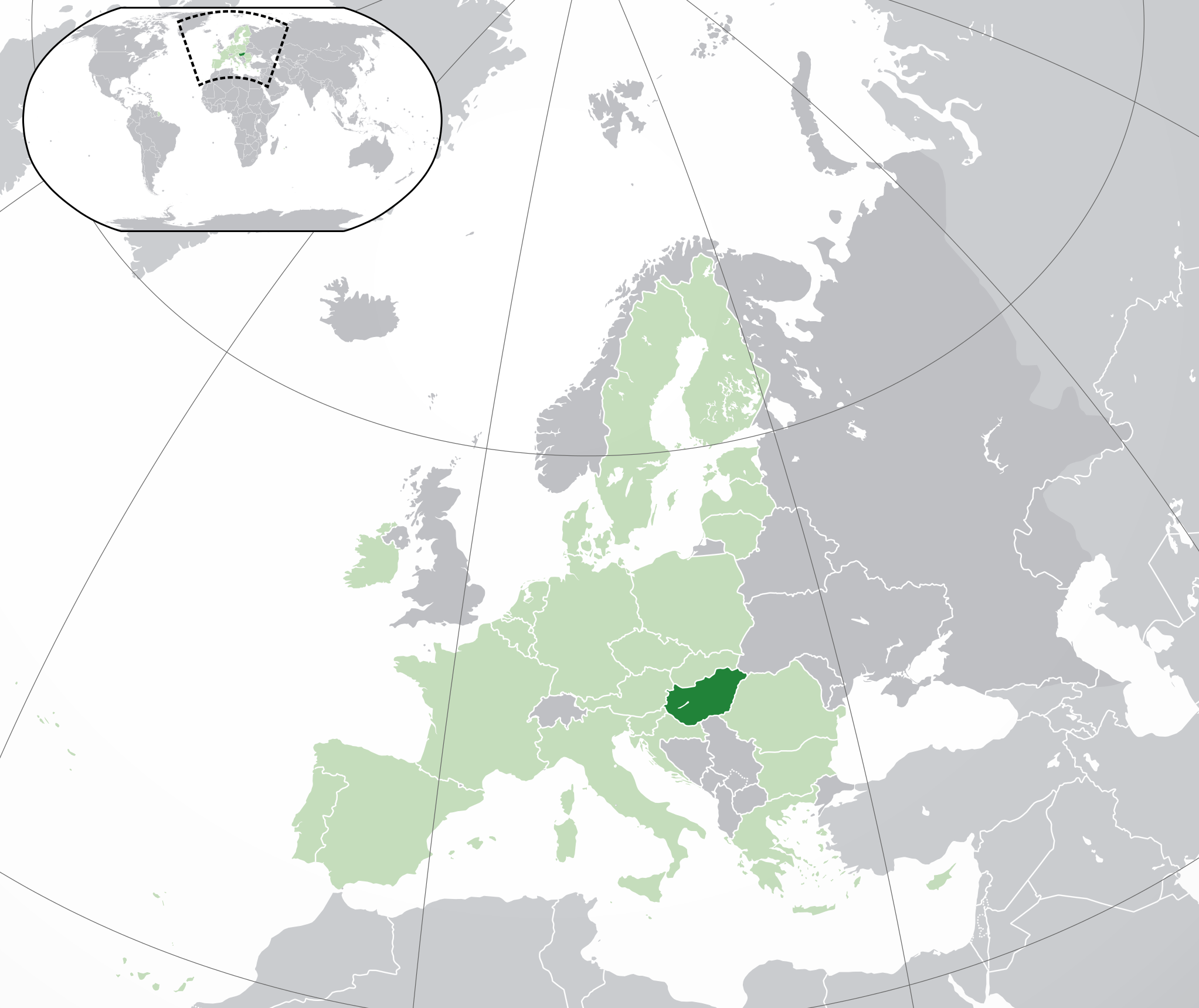
English: (Dark-Green) Hungary. (Light-Green) The rest of the European Union (EU). (Dark-gray) The rest of Europe. (Light-gray) The surrounding region.
See also: |
| SVG genesis | |
| Date | |
| Source | |
| Author | NuclearVacuum |
| Other versions |
|


Licensing
I, the copyright holder of this work, hereby publish it under the following licenses:
This file is licensed under the Creative Commons Attribution-Share Alike 3.0 Unported license.
- You are free:
- to share – to copy, distribute and transmit the work
- to remix – to adapt the work
- Under the following conditions:
- attribution – You must give appropriate credit, provide a link to the license, and indicate if changes were made. You may do so in any reasonable manner, but not in any way that suggests the licensor endorses you or your use.
- share alike – If you remix, transform, or build upon the material, you must distribute your contributions under the same or compatible license as the original.

|
Permission is granted to copy, distribute and/or modify this document under the terms of the GNU Free Documentation License, Version 1.2 or any later version published by the Free Software Foundation; with no Invariant Sections, no Front-Cover Texts, and no Back-Cover Texts. A copy of the license is included in the section entitled GNU Free Documentation License. |
You may select the license of your choice.
File history
Click on a date/time to view the file as it appeared at that time.
| Date/Time | Thumbnail | Dimensions | User | Comment | |
|---|---|---|---|---|---|
| current | 05:02, 1 Februari 2020 | | 2,045 × 1,720 (7.33 MB) | Rob984 | UK and Gibraltar have left the EU. New base which includes all of Portugal's islands within frame, as well as Arctic Russian islands part of Europe. Also fixed Flevoland in the Netherlands. |
| 20:29, 25 Oktoba 2016 |  | 2,045 × 1,720 (7.32 MB) | Giorgi Balakhadze | + some lakes | |
| 11:55, 4 Februari 2015 |  | 2,045 × 1,720 (2.62 MB) | BRUTE | Reverted to version as of 16:33, 16 November 2014 Please respect COM:OVERWRITE | |
| 19:39, 16 Novemba 2014 |  | 2,045 × 1,720 (7.38 MB) | Leftcry | Reverted to version as of 23:04, 18 October 2014 Please go to your talk page | |
| 16:33, 16 Novemba 2014 |  | 2,045 × 1,720 (2.62 MB) | A2D2 | The map must show the original de-jure status with no breakaway regions, as it was originally created. An alternative map showing the de-facto status with breakaway regions needs to be created instead. | |
| 23:04, 18 Oktoba 2014 |  | 2,045 × 1,720 (7.38 MB) | Leftcry | Improved version | |
| 09:04, 1 Julae 2013 |  | 2,045 × 1,720 (2.62 MB) | U5K0 | croatia | |
| 12:36, 10 Julae 2012 |  | 2,045 × 1,720 (2.62 MB) | Domaina | minor | |
| 00:46, 23 Oktoba 2009 |  | 2,045 × 1,720 (2.61 MB) | NuclearVacuum | consensus version | |
| 18:13, 18 Oktoba 2009 |  | 2,045 × 1,720 (2.62 MB) | NuclearVacuum | final version |
File usage
The following page uses this file:
Global file usage
The following other wikis use this file:
- Usage on ady.wikipedia.org
- Usage on af.wikipedia.org
- Usage on als.wikipedia.org
- Usage on ami.wikipedia.org
- Usage on ang.wikipedia.org
- Usage on arc.wikipedia.org
- Usage on ar.wikipedia.org
- المجر
- مستخدم:ElWaliElAlaoui/ملعب 8
- معاملة المثليين في المجر
- مستخدم:جار الله/قائمة صور مقالات العلاقات الثنائية
- العلاقات المجرية الأمريكية
- العلاقات الأنغولية المجرية
- العلاقات المجرية الكورية الجنوبية
- العلاقات المجرية الإريترية
- العلاقات المجرية السويسرية
- العلاقات الألمانية المجرية
- العلاقات المجرية الليختنشتانية
- العلاقات المجرية البوليفية
- العلاقات المجرية الموزمبيقية
- العلاقات الألبانية المجرية
- العلاقات المجرية البلجيكية
- العلاقات المجرية الإثيوبية
- العلاقات المجرية البيلاروسية
- العلاقات المجرية الطاجيكستانية
- العلاقات المجرية الرومانية
- العلاقات الأرجنتينية المجرية
- العلاقات المجرية الغامبية
- العلاقات المجرية القبرصية
- العلاقات المجرية السيراليونية
- العلاقات المجرية النيبالية
- العلاقات المجرية الليبيرية
- العلاقات التشيكية المجرية
- العلاقات المجرية الميانمارية
- العلاقات المجرية الكندية
- العلاقات السعودية المجرية
- العلاقات المجرية الزيمبابوية
- العلاقات المجرية الإسرائيلية
- العلاقات المجرية البالاوية
- العلاقات المجرية المالية
- العلاقات المجرية النيجيرية
- العلاقات المجرية اليمنية
- العلاقات المجرية الفانواتية
- العلاقات الغابونية المجرية
- العلاقات المجرية البنمية
- العلاقات المجرية الكوبية
- العلاقات المجرية الجورجية
- العلاقات المجرية التونسية
- العلاقات المجرية الكورية الشمالية
- العلاقات المجرية الهندية
View more global usage of this file.