File:HND orthographic.svg

Size of this PNG preview of this SVG file: 550 × 550 pixels. Other resolutions: 240 × 240 pixels | 480 × 480 pixels | 768 × 768 pixels | 1,024 × 1,024 pixels | 2,048 × 2,048 pixels.
Original file (SVG file, nominally 550 × 550 pixels, file size: 1.09 MB)
Summary
| Description |
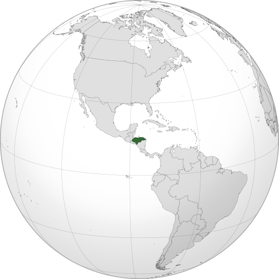
English: Orthographic map of Honduras centered at 15° N, 86° W.
Official territory.
Claimed territories. |
| Date | |
| Source |
Own work with Natural Earth Data This W3C-unspecified vector image was created with Inkscape . |
| Author | Addicted04 |
Licensing
I, the copyright holder of this work, hereby publish it under the following license:
This file is licensed under the Creative Commons Attribution-Share Alike 3.0 Unported license.
- You are free:
- to share – to copy, distribute and transmit the work
- to remix – to adapt the work
- Under the following conditions:
- attribution – You must give appropriate credit, provide a link to the license, and indicate if changes were made. You may do so in any reasonable manner, but not in any way that suggests the licensor endorses you or your use.
- share alike – If you remix, transform, or build upon the material, you must distribute your contributions under the same or compatible license as the original.
File history
Click on a date/time to view the file as it appeared at that time.
| Date/Time | Thumbnail | Dimensions | User | Comment | |
|---|---|---|---|---|---|
| current | 23:01, 8 Desemba 2011 | | 550 × 550 (1.09 MB) | Addicted04 |
File usage
The following page uses this file:
Global file usage
The following other wikis use this file:
- Usage on avk.wikipedia.org
- Usage on bg.wikipedia.org
- Usage on ceb.wikipedia.org
- Usage on de.wikipedia.org
- Usage on en.wikipedia.org
- Usage on es.wikipedia.org
- Honduras
- Usuario Discusión:Jcsanchez1
- Usuario discusión:Ruben bardales85
- Wikiproyecto:Honduras
- Usuario discusión:GiovanniB374
- Usuario:Addicted04/Archivo de discusión 01
- Usuario Discusión:RubiksMaster110
- Usuario Discusión:Historiador99
- Usuario discusión:Katuketi
- Portal:Honduras/Introducción
- Portal:Honduras
- Wikiproyecto:Honduras/Bienvenida
- Usuario:Santi Chuco/Agenda4
- Usuario discusión:Jmschon
- Wikiproyecto:Ilustración/Taller de Cartografía/Realizaciones/Mapas ortográficos/América del Norte
- Diversidad sexual en Honduras
- Dictaduras en Honduras
- Usage on fi.wikipedia.org
- Usage on he.wikipedia.org
- Usage on ia.wikipedia.org
- Usage on id.wikibooks.org
- Usage on ie.wikipedia.org
- Usage on ilo.wikipedia.org
- Usage on incubator.wikimedia.org
- Usage on ko.wikipedia.org
- Usage on lad.wikipedia.org
- Usage on lfn.wikipedia.org
- Usage on lo.wikipedia.org
- Usage on mg.wikipedia.org
- Usage on mn.wikipedia.org
- Usage on mt.wikipedia.org
- Usage on mwl.wikipedia.org
- Usage on mzn.wikipedia.org
- Usage on pl.wikipedia.org
- Usage on ru.wikipedia.org
- Usage on sat.wikipedia.org
View more global usage of this file.