File:New Caledonia and Vanuatu bathymetric and topographic map-fr.jpg

Size of this preview: 800 × 561 pixels. Other resolutions: 320 × 224 pixels | 640 × 449 pixels | 1,024 × 718 pixels | 1,280 × 898 pixels | 2,560 × 1,795 pixels | 2,980 × 2,090 pixels.
Original file (2,980 × 2,090 pixels, file size: 1.53 MB, MIME type: image/jpeg)
Summary
| Description |
|
||
| Date | ; revision 2013-12 | ||
| Source |
Own work ;
|
||
| Author | Eric Gaba (Sting - fr:Sting) | ||
| Permission (Reusing this file) |
|
||
| Other versions |
[]
Administrative and simplified version:
|


| Camera location | | View this and other nearby images on: OpenStreetMap |
|---|
Licensing
I, the copyright holder of this work, hereby publish it under the following licenses:

|
Permission is granted to copy, distribute and/or modify this document under the terms of the GNU Free Documentation License, Version 1.2 or any later version published by the Free Software Foundation; with no Invariant Sections, no Front-Cover Texts, and no Back-Cover Texts. A copy of the license is included in the section entitled GNU Free Documentation License. |
This file is licensed under the Creative Commons Attribution-Share Alike 4.0 International, 3.0 Unported, 2.5 Generic, 2.0 Generic and 1.0 Generic license.
- You are free:
- to share – to copy, distribute and transmit the work
- to remix – to adapt the work
- Under the following conditions:
- attribution – You must give appropriate credit, provide a link to the license, and indicate if changes were made. You may do so in any reasonable manner, but not in any way that suggests the licensor endorses you or your use.
- share alike – If you remix, transform, or build upon the material, you must distribute your contributions under the same or compatible license as the original.
You may select the license of your choice.
File history
Click on a date/time to view the file as it appeared at that time.
| Date/Time | Thumbnail | Dimensions | User | Comment | |
|---|---|---|---|---|---|
| current | 17:40, 19 Desemba 2013 | | 2,980 × 2,090 (1.53 MB) | Sting | Île de Sable removed (cf http://www.shom.fr/fileadmin/data-www/DMI/Communiques_de_presse/2012/COMMUNIQUE-DE-PRESSE-SANDY-ISLAND.doc) ; new elevation data used (SRTM30 Plus) |
| 11:38, 30 Mei 2011 |  | 2,980 × 2,090 (1.46 MB) | Sting | Reverted to version as of 21:32, 16 July 2010 (sRGB profile) | |
| 20:40, 17 Julae 2010 |  | 2,980 × 2,090 (1.35 MB) | Sting | Better unsaturated colors than over-saturated ones in non color managed browsers | |
| 21:32, 16 Julae 2010 |  | 2,980 × 2,090 (1.46 MB) | Sting | Color profile correction | |
| 23:05, 29 Jun 2010 |  | 2,980 × 2,090 (1.35 MB) | Sting | With sRGB color profile | |
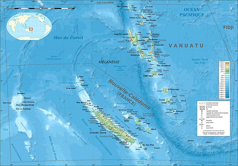
| 03:12, 17 Februari 2009 |  | 2,980 × 2,090 (1.39 MB) | Sting | == Summary == {{Location|18|30|00|S|166|00|00|E|scale:10000000}} <br/> {{Information |Description={{en|Bathymetric and topographic map of New Caledonia and Vanuatu, Oceania.}} {{fr|Carte bathymétrique |
File usage
The following page uses this file:
Global file usage
The following other wikis use this file:
- Usage on avk.wikipedia.org
- Usage on azb.wikipedia.org
- Usage on bg.wikipedia.org
- Usage on bs.wikinews.org
- Usage on en.wikipedia.org
- Usage on eo.wikipedia.org
- Usage on es.wikipedia.org
- Usage on fi.wikipedia.org
- Usage on fr.wikipedia.org
- Vanuatu
- Liste des colonies françaises
- Christian Zuber
- Nouvelle-Calédonie
- Référendum en France
- Projet:Cartographie/Cartes standards/Pays
- 2010 par pays en Océanie
- 2011 par pays en Océanie
- Rallye de Nouvelle-Calédonie
- Français océanien
- Utilisateur:Exp JC/Brouillon
- Environnement en Nouvelle-Calédonie
- 2010 en Nouvelle-Calédonie
- 2011 au Vanuatu
- 2010 au Vanuatu
- Usage on fr.wikinews.org
- Usage on fr.wikiversity.org
- Usage on gcr.wikipedia.org
- Usage on gl.wikipedia.org
- Usage on he.wikipedia.org
- Usage on hu.wikipedia.org
- Usage on ky.wikipedia.org
- Usage on la.wikipedia.org
- Usage on lfn.wikipedia.org
- Usage on nl.wikipedia.org
- Usage on nn.wikipedia.org
- Usage on oc.wikipedia.org
- Usage on pl.wikipedia.org
- Usage on pl.wikivoyage.org
- Usage on pt.wikipedia.org
View more global usage of this file.